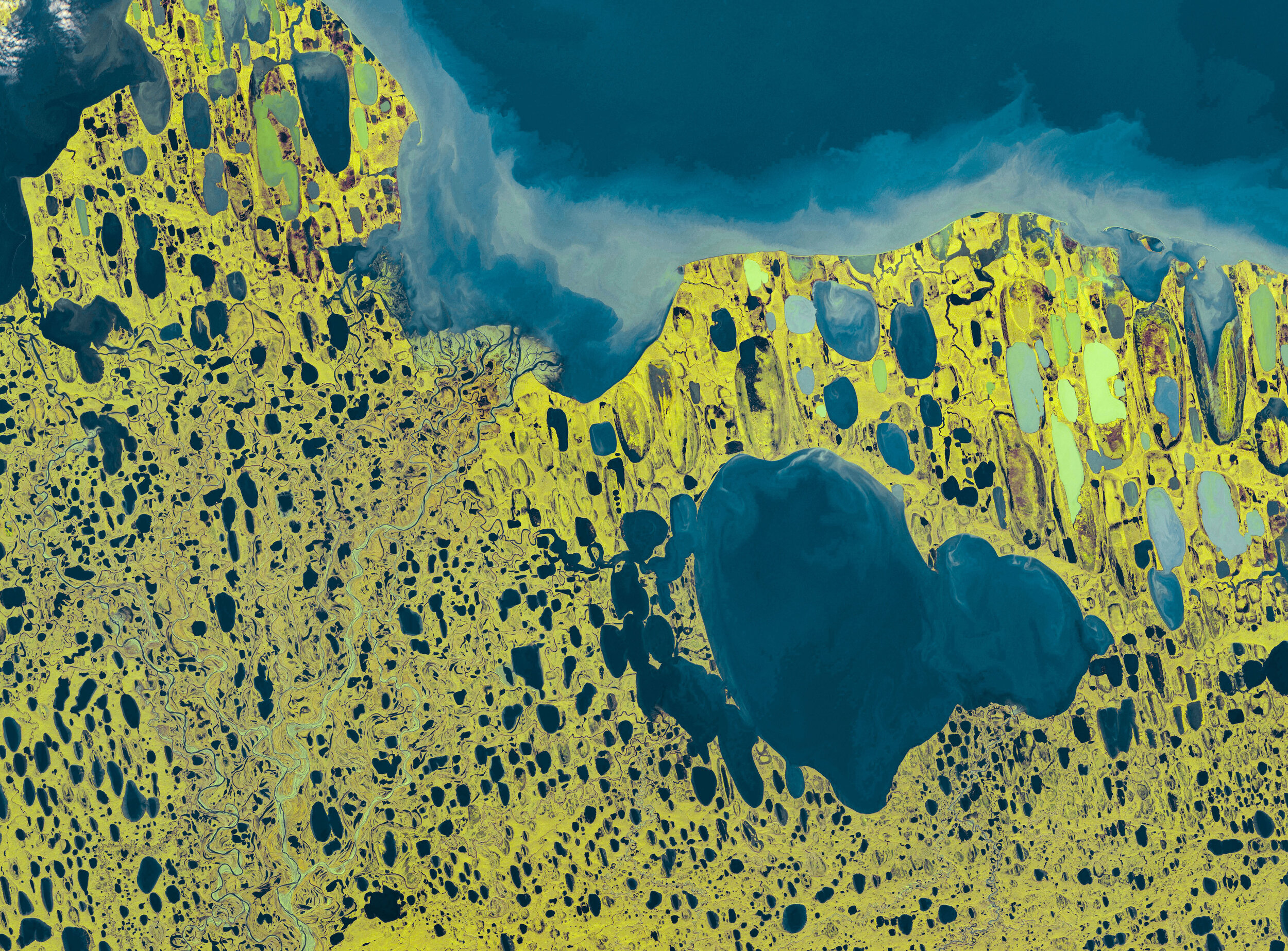
False color Sentinel-2 image, with green/yellow showing vegetation and blue showing water, from September 28, 2019.
In fourth grade, when we were each assigned to study a state, I remember someone bragging that their state Minnesota’s motto was “Land of 10,000 Lakes”. Those were competitive years, so I did a quick search, finding that my state, Alaska, had over 3,000,000 lakes. I remember looking at a map and discovering that the North Slope of Alaska, pictured here, looked like Swiss cheese—more lake than land.
It’s thought that the orientation of these parallel thermokarst (thaw) lakes near the shoreline is no coincidence. As winter turns to summer, the upper layers of ice melt, and areas that had particular weight in ice become depressed, allowing water to pool. Prevailing summer ocean winds break the temperature equilibrium and allow continued thawing parallel to the wind direction, giving the shore lakes an oblong shape. These formations are fragile: resting only on permafrost, that if melts, means the lake becomes absorbed into the ground forever.
With warmer temperatures, these lakes are part of a positive feedback cycle by which expanding waters contribute to further melting of permafrost, releasing methane which contributes to more warming.
The largest lake in this frame is called Teshekpuk, at 35km wide. It is the largest lake in the American Arctic.
Satellite data from ESA’s Copernicus program. CC BY-SA 3.0 IGO.
