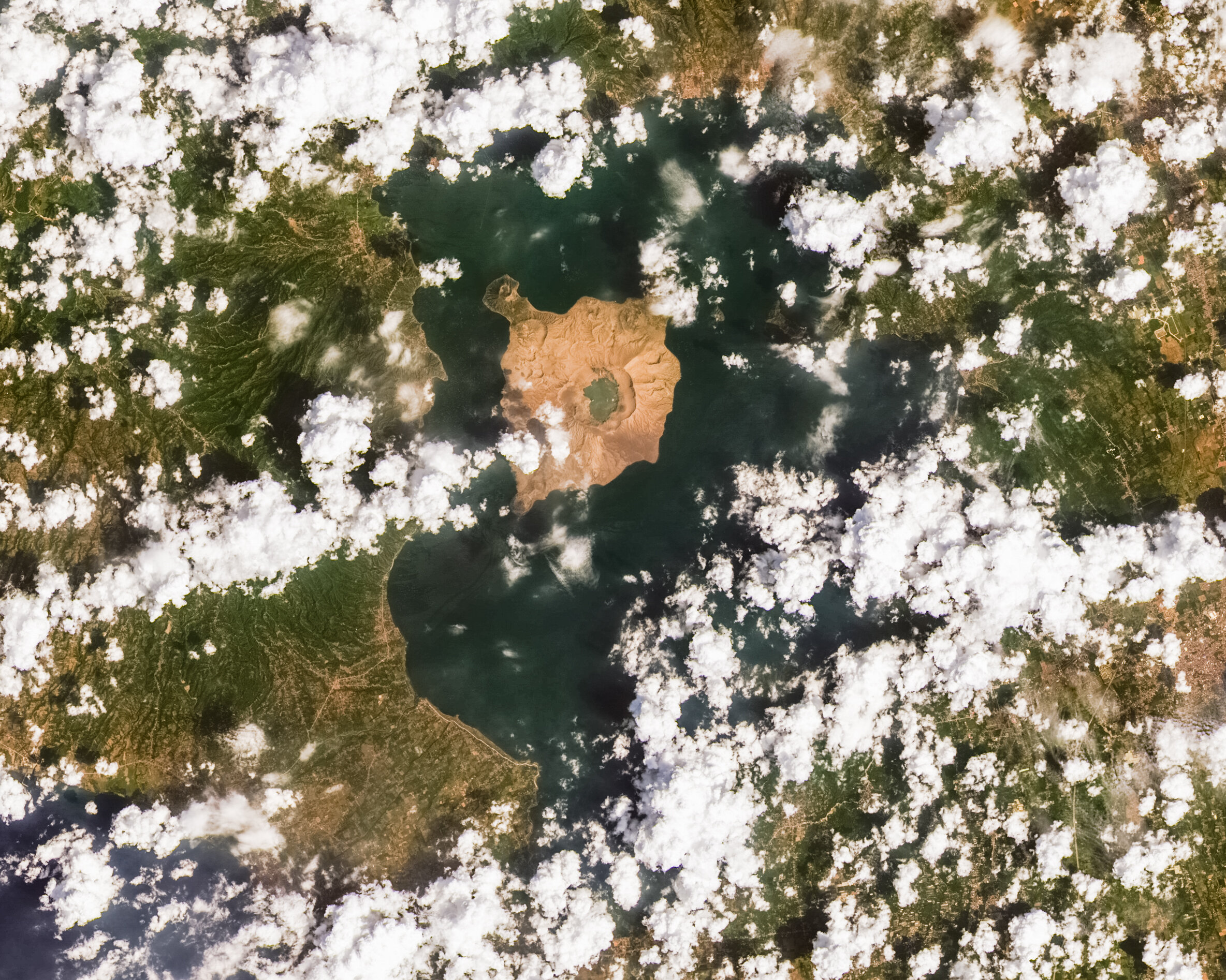
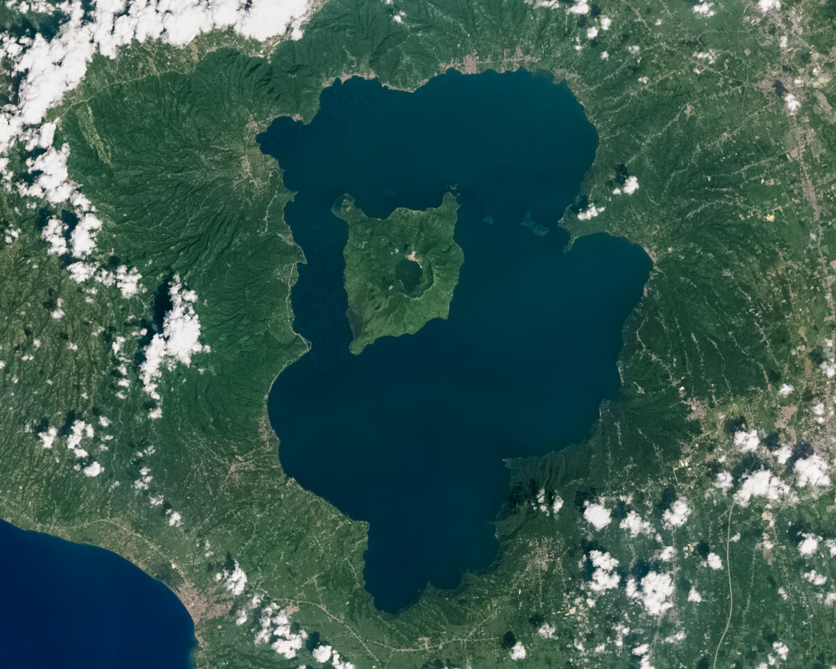
I put together this before and after of the recent eruption in Taal from January 12, 2020 to show the extent of ash in the surrounding areas (image 1 from February 2019, image 2 from March 2020). Located on the island of Luzon, the caldera of Taal is also the third largest lake in the Philippines. Within this lake lies Volcano Island, which itself has a lake called Crater Lake, which until this eruption contained an island itself, called Vulcan Point. This island within an island within an island is technically called a third-order (or recursive) island, which is very rare (here’s another potential one in Canada: 69.793° N, 108.241° W).
Despite being one of the most active volcanoes in the Philippines, homes of nearly 6000 residents can be seen along the shores of the inner Volcano Island, while Metro Manila is a mere 40 miles away. The eruption caught hundreds of thousands of people who live within mere miles of the volcano off guard, while air traffic was shut down. Here’s one place to read more on the impact of life, farmland, health, and the Philippine response.
The eruption was of phreatomagmatic nature, which involves the explosive interaction between magma and water, leading to immense amounts of ejected steam and ash.
A closer view of the third order island (Vulcan Point), which I measured to be 300’ long. Source: maps.google.com.
Satellite data modified from NASA/USGS’s Landsat 8. CC BY-SA 3.0 IGO.

