
As I quarantine under a 9pm sun here in Kangerlussuaq, Greenland waiting to deploy to the ice sheet, I figured it would be fun to edit some photos beamed down from space to explore the land around me.
On one hand, simply being here has made me realize how humans have truly spread across the entire planet—there are few corners of the globe left that you can go that require more effort than plopping yourself on some plane, car or boat for a day or so. Yet in the Arctic, perhaps more than anywhere else, the concept of “familiar” still doesn’t really exist. Locked under ice most of the year, desolate, dark, sparsely populated: this could just as well be a landscape of a recently discovered planet.

The Belcher Islands (Sanikiluaq) of the Hudson Bay remain frozen most of the year.

Nettilling Lake, Baffin Island, is the largest lake on any island in the world. Try to find an island within an island within an island within this scene.
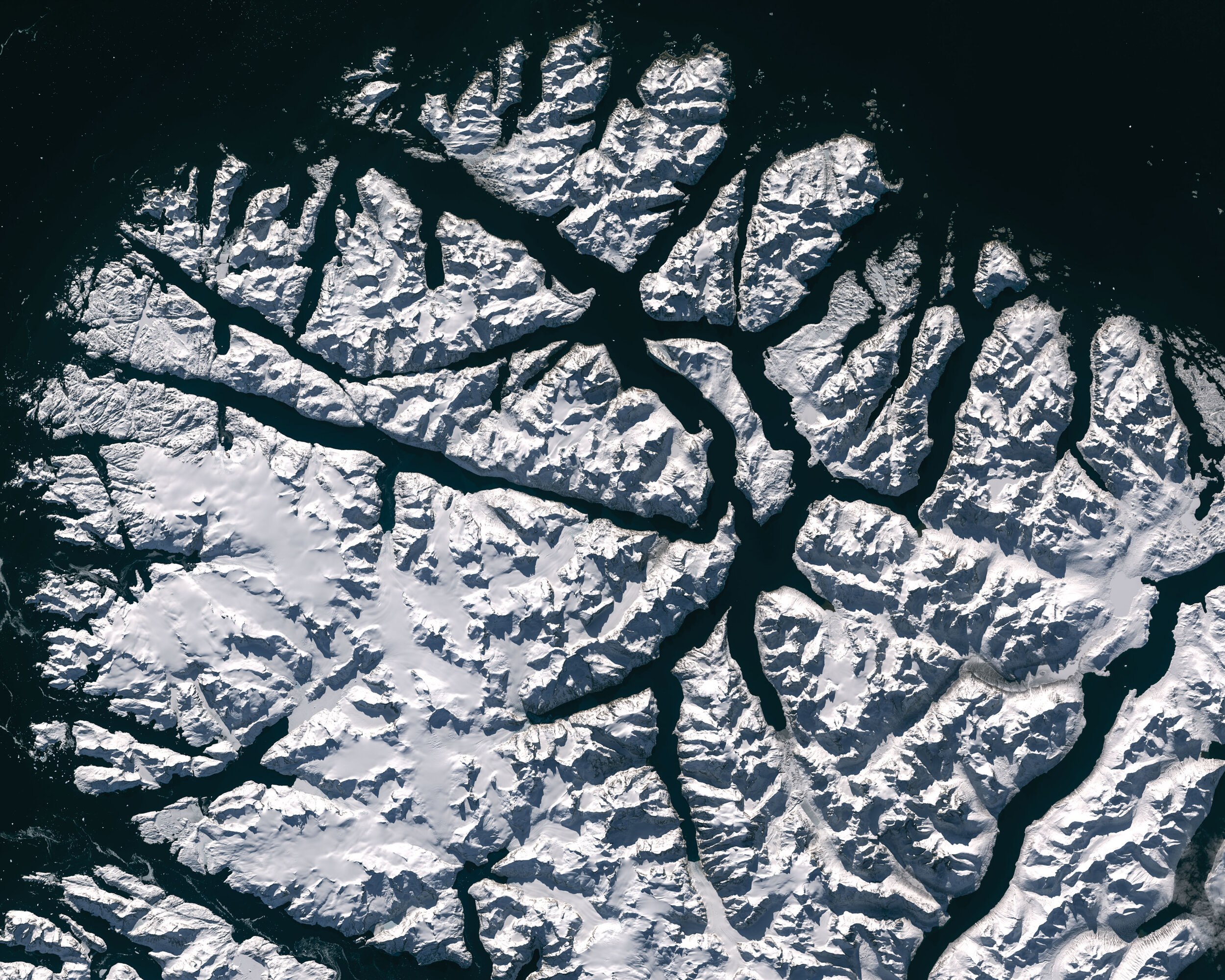
The southern tip of Greenland (up is south) is a complex labyrinth of fjords and islands.
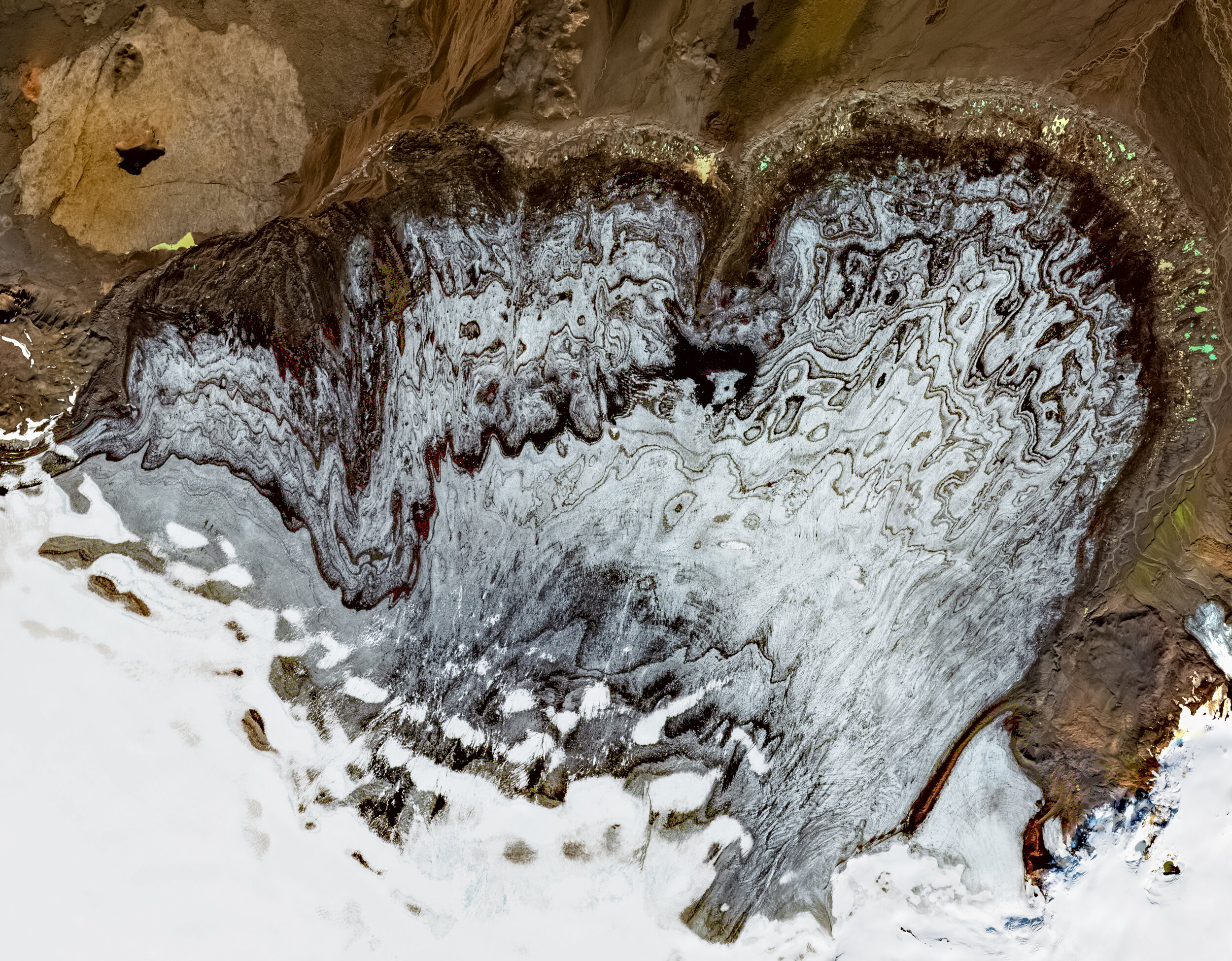
Dyngjujökull is a glacier extension of the Vatnajökull icecap in Iceland that rests precariously atop a stratovolcano.
Satellite data modified from NASA/USGS’s Landsat 8. CC BY-SA 3.0 IGO.
Additional data from ESA’s Copernicus program. CC BY-SA 3.0 IGO.